Download the Free FlySafe App now...

Play Video

Find out more about our policy coverage

Coverdrone FlySafe is a completely free app designed to help our customers plan and conduct their drone flights quicker and safer than before.

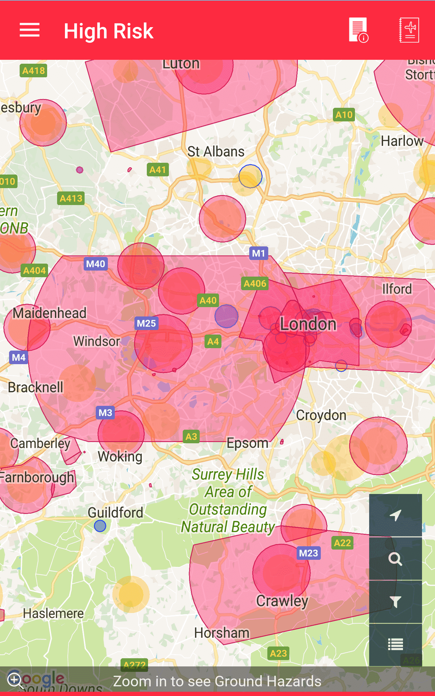
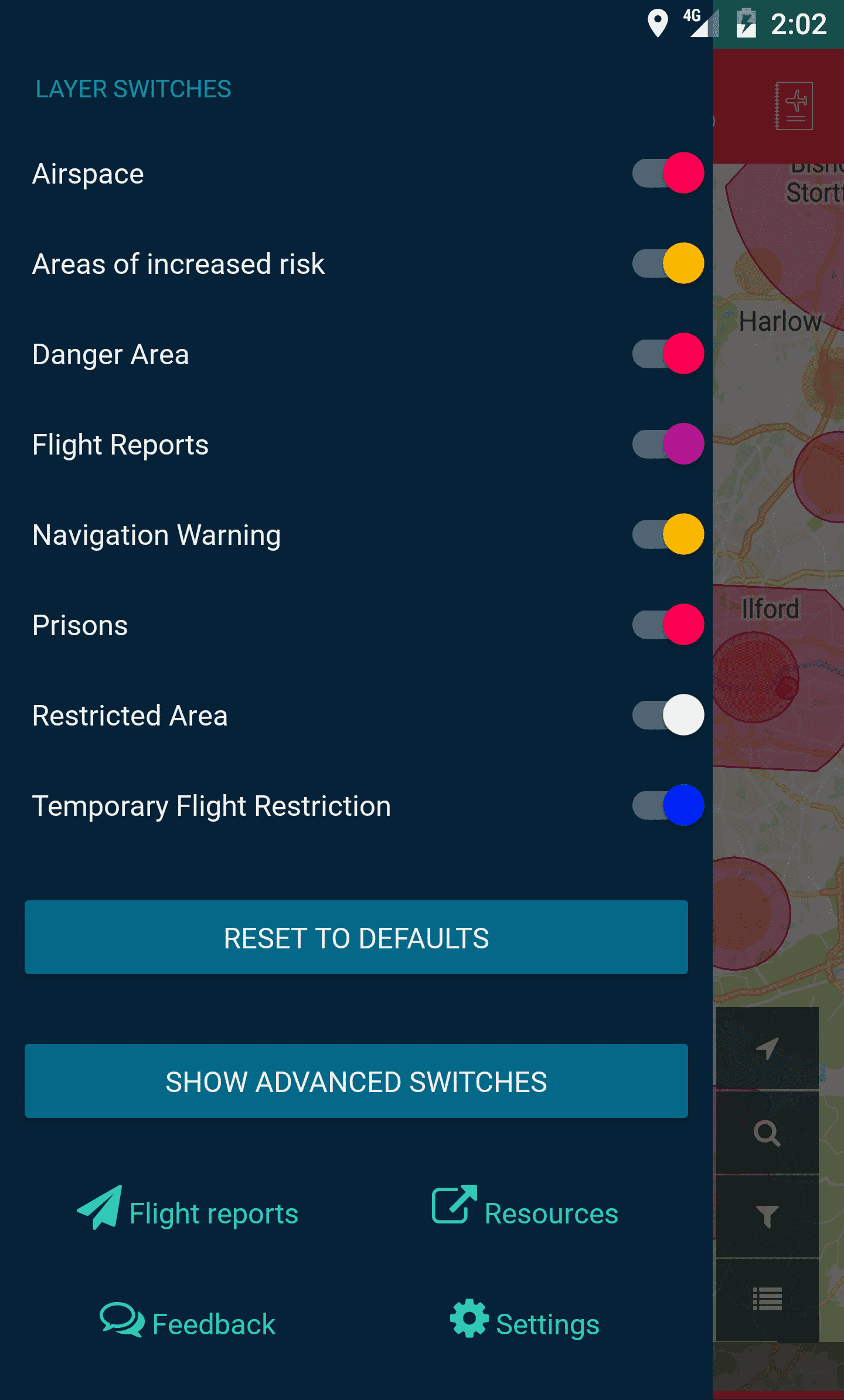
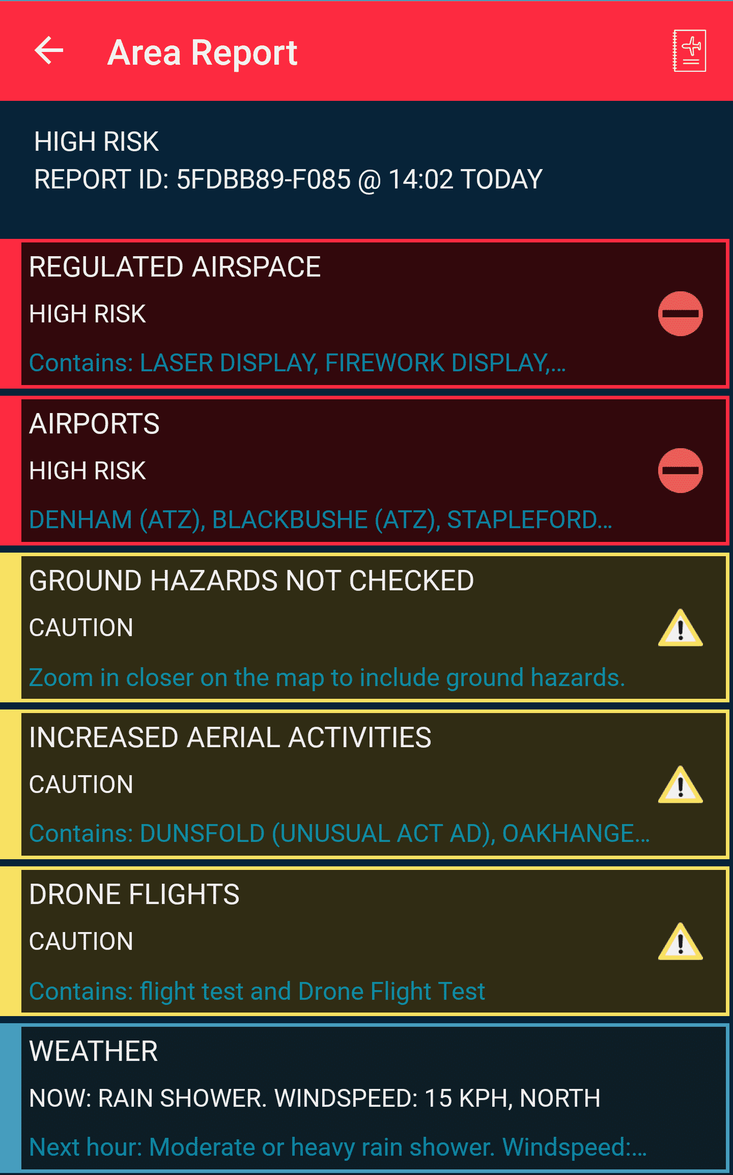
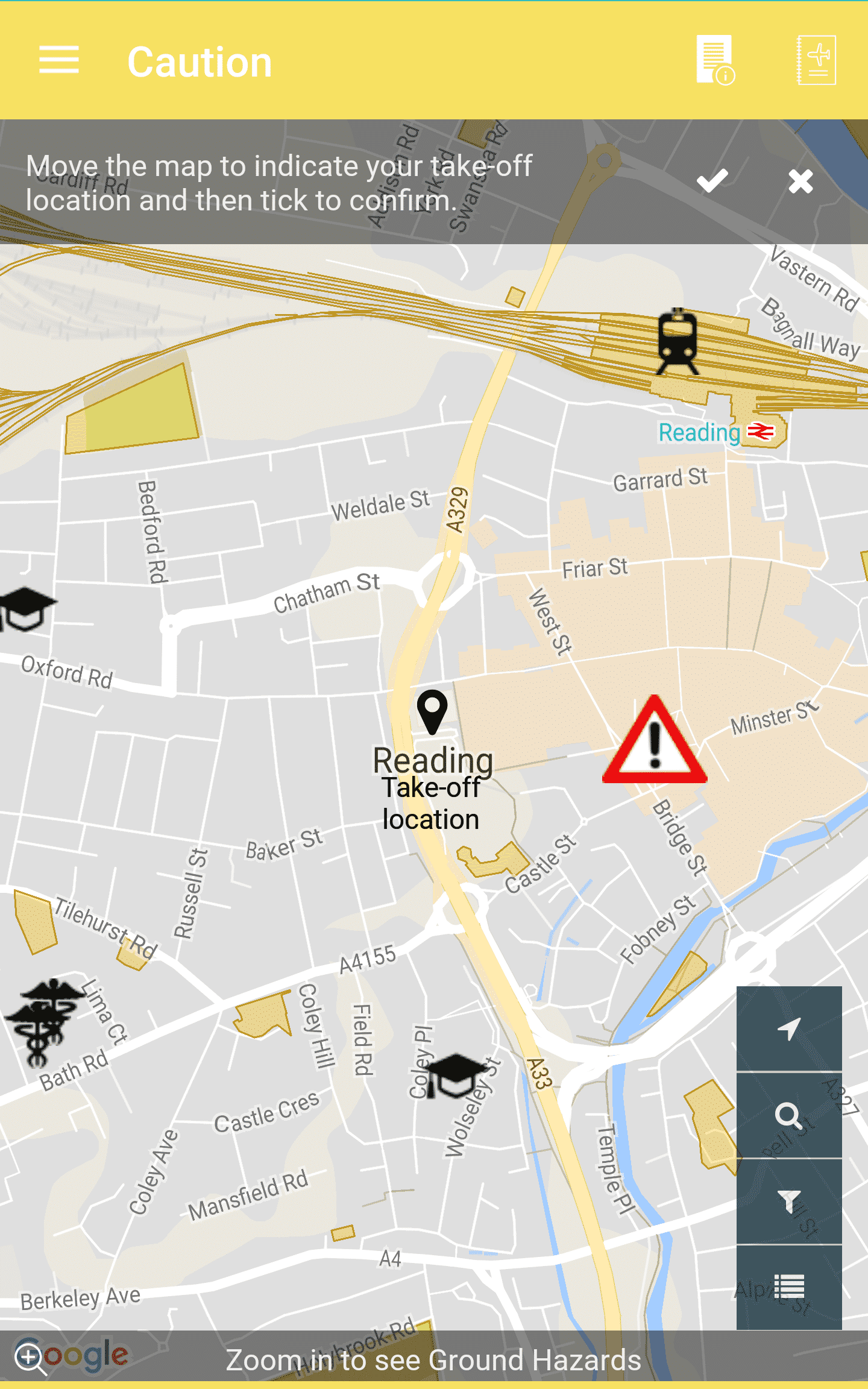
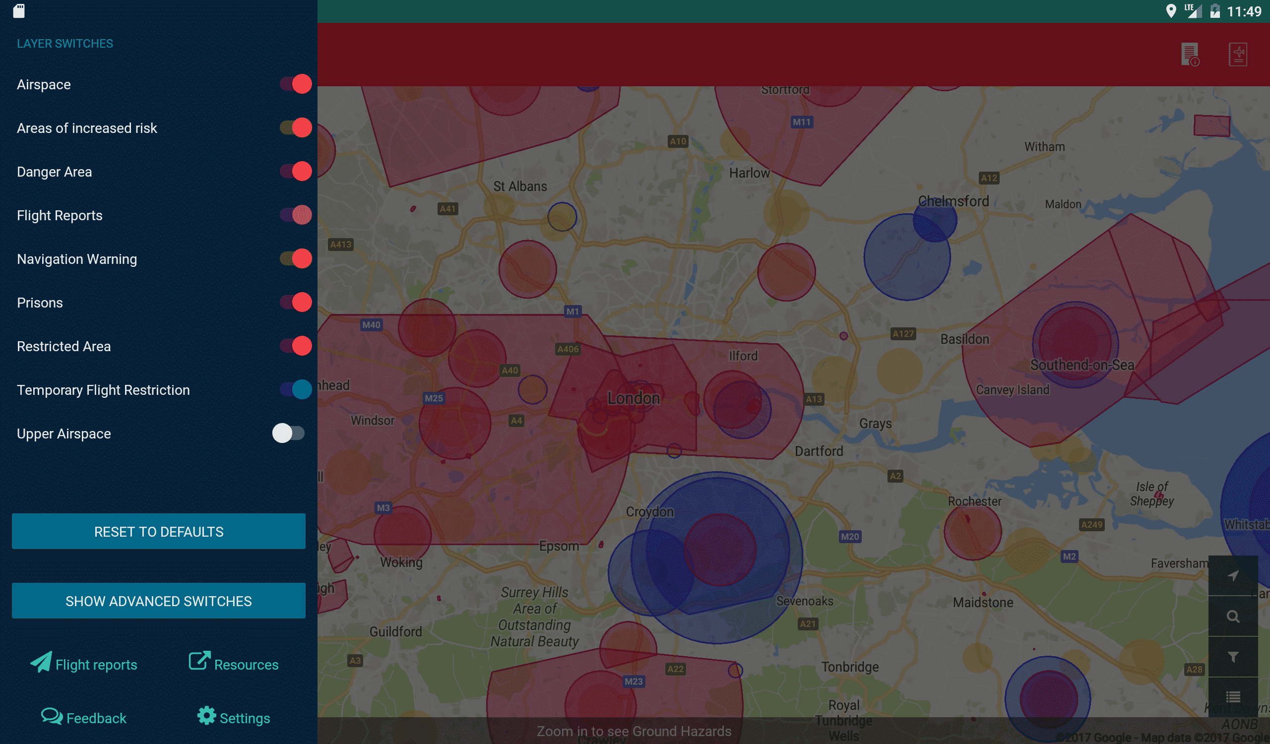
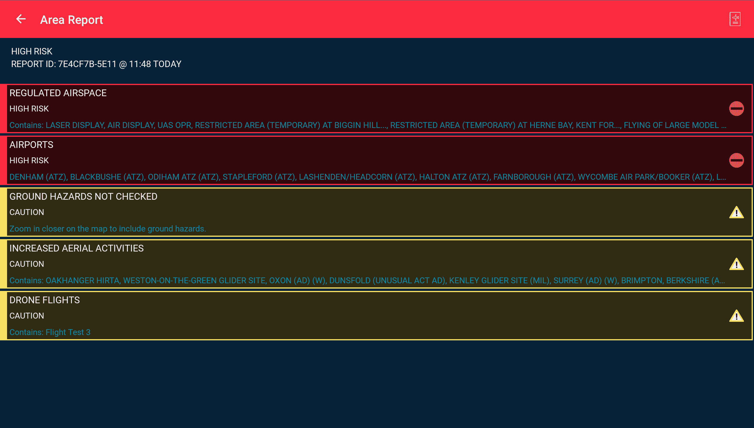
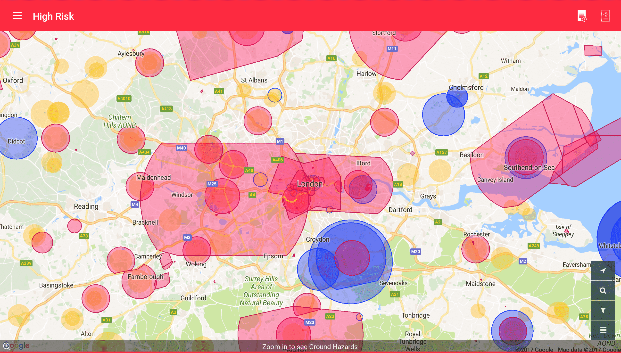
The companion app (available for iPhone, iPad and Android devices) delivers rich and accurate safety data ranging from airspace maps, dynamic restrictions, environmental conditions, privacy and safety hazards and even the location of much of the low-flying manned aviation traffic, straight to the palm of your hand.

Commercial and recreational drone operators should always ensure that they are kept well within Aviation Authority Regulations and with our new app we want to make staying safe and legal as easy as possible, whilst also saving operators time and making them more productive.

The Coverdrone FlySafe app, powered by Altitude Angel, is completely free of charge for ALL existing and new Coverdrone clients and provides some exciting features:

Airspace restrictions

  • Regulated airspace information
  • Airports
  • Areas of other increased aerial activities (e.g. glider sites etc)
  • Drone relevant NOTAM information (e.g. temporary restrictions or navigation warnings)

Ground hazard information

  • Critical Infrastructure (e.g. power lines, gasometers etc)
  • Transport Infrastructure (e.g. stations)
  • Privacy Hazard (e.g. schools, hospitals etc)
  • Pedestrian Hazards (e.g. parks etc)

Reporting

  • Area reports – Receive a categorised summary of restrictions, hazards and weather forecast information for a flight location.
  • Flight reports – Provide visibility of your flight (current or planned) to other drone users on the data exchange network.

Alerts & Feedback

  • Airspace Alerts allow the monitoring of your reported flight and we will track manned aviation (visible by ADS-B) and notify you if there is a potential conflict.
  • Help steer new application features by providing feedback based on your usage.

Device Support

Coverdrone FlySafe is available for Android and iOS devices. (those devices running the latest OS version and one predecessor).

The app has been developed in partnership with Altitude Angel, a leading UK-based company working on innovative future drone traffic management solutions.

Supported Countries

Member States of the European Union (including the UK), Canada, New Zealand, Australia and the United States of America.

The app also contains a ‘Fly Now’ feature that will share the user’s drone flight location with other app users, and the wider drone community, helping to reduce the risk of a drone related incident.